
From the sea to the sky
Often, the journey is a lot more interesting, and beautiful, than the destination itself. One such journey is the legendary Sea-to-Sky corridor.
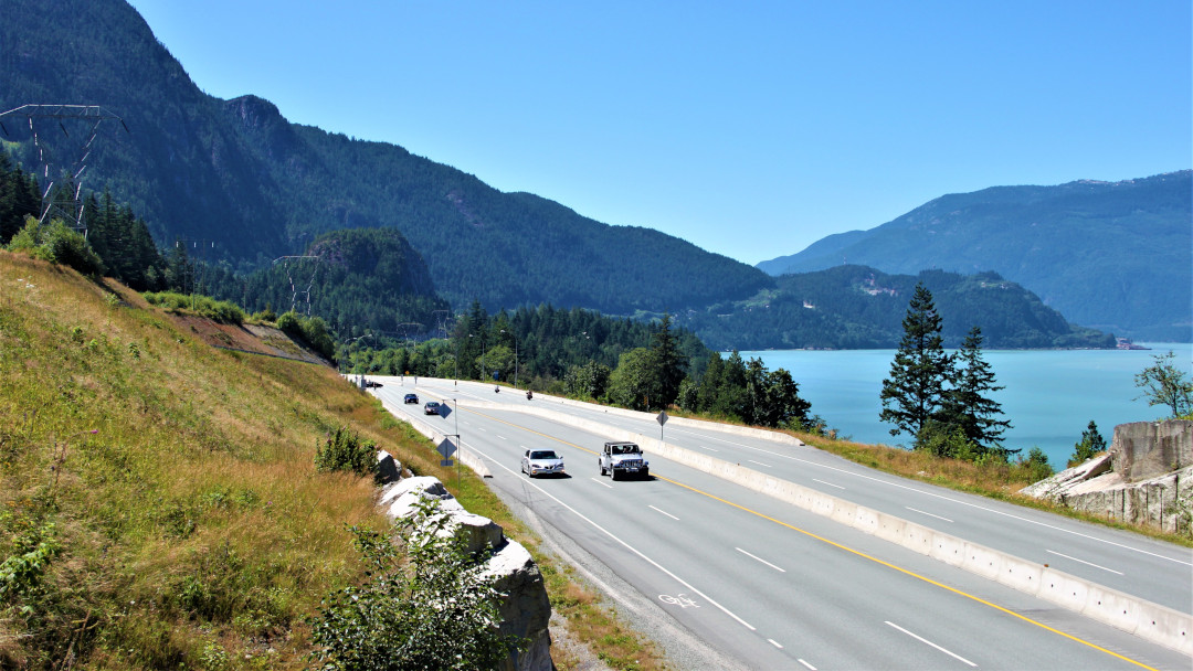
Chances are, if you are driving from Vancouver to Whistler, then you will find yourself cruising on the Sea-to-Sky corridor, or British Columbia Highway 99 (BC 99). While the two points are roughly about 120km apart, it has some of the most awe-inspiring scenery I’ve seen so far. So, a drive that would ordinarily take an hour and a half at the most, takes that much longer. With landscape as beautiful as this, it is hard not to make a few pit-stops on the journey – from lakes and waterfalls to mountains.
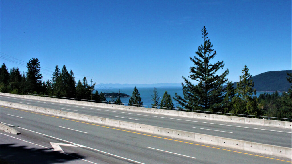
A leisurely drive along the Sea-to-Sky corridor is when it dawns on you as to why it is so called. With the sea on one side and the mountainside on the other, it makes for stunning views. It also takes you from the waters of Vancouver to the clear skies and mountains of Whistler. Interestingly, BC Highway 99 that goes all the way to the US border, gets its number from the US Route 99 which doesn’t exist anymore.
Understand history
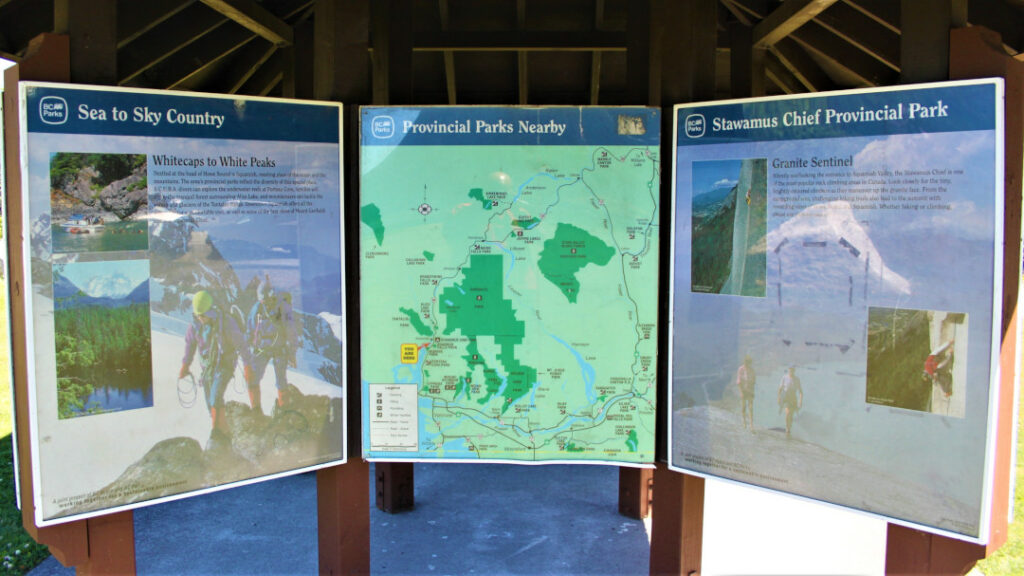
Among the first pit-stops you are sure to make is at the Stawamus Chief Provincial Park tourist hut. Located within Squamish, or Mother of the Wind, it lies on the Sea-to-Sky corridor.

Park your vehicle and explore a little bit. A short trail up and you will come to it. It has information on the rich history of Canada’s First nations population called Squamish Nation. They are descendants of the Coast Salish Indigenous Peoples who governed this region for more than 10,000 years.
All hail the chief
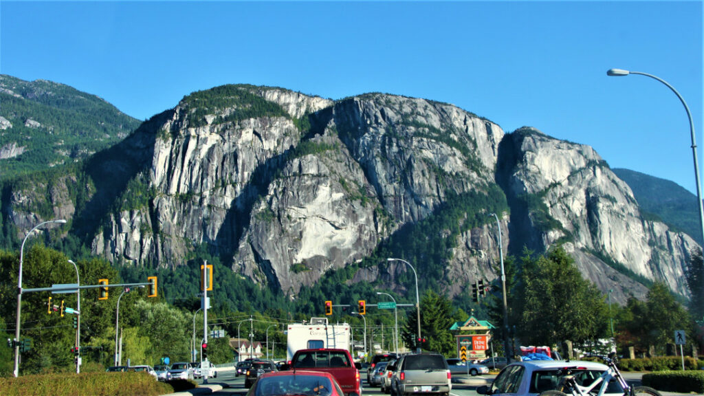
As you continue your drive on the Sea-to-Sky corridor, you will see it for miles before you pass right beneath the base. Towering over the town of Squamish is the Stawamus Chief. At 700m, it is the second largest granite monolith in the world, right behind the Rock of Gibraltar. The Chief has three distinct summits, simply known as First, Second and Third Peak. For the outdoor types who love a challenge, this makes for an excellent stopover on your journey. While we continued to drive, you can pull over at a safe and convenient spot to get the best views.
Walk around the lakes
A short drive from Squamish and you come to Alice Lake. With views of the mountains, forests and grass, it is a popular tourist spot for lots of Canadian families. If you are up to it, take a leisurely stroll around Alice Lake.
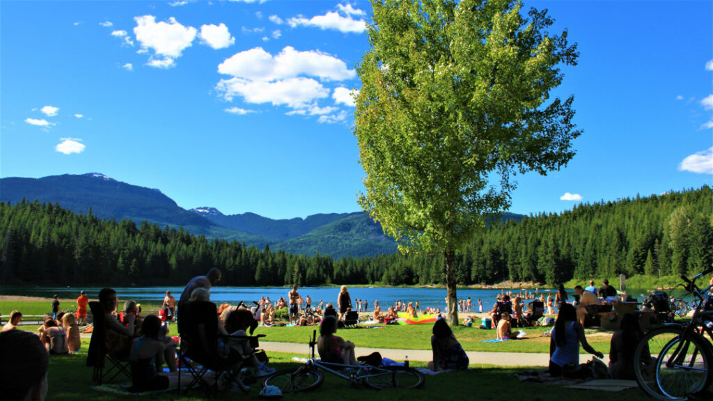
For the more adventurous, go along the Four Lakes Trail loop 6km long. It is so named as there are four freshwater lakes that dominate the landscape.

Say hello to the Greeks
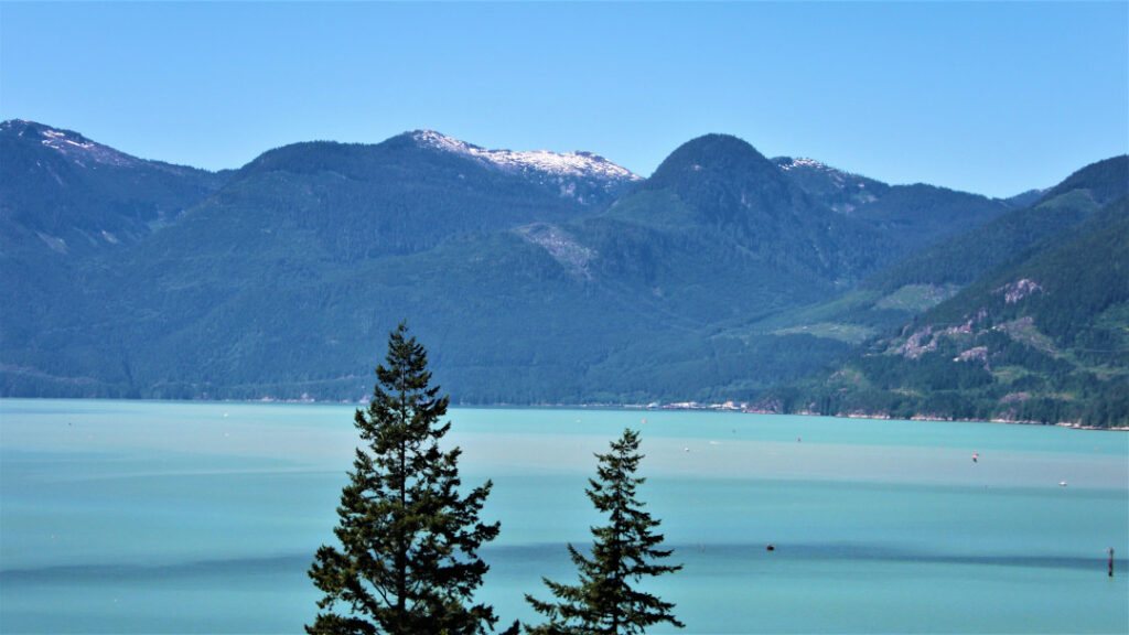
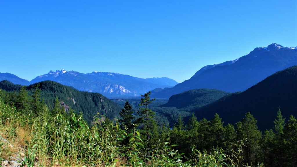
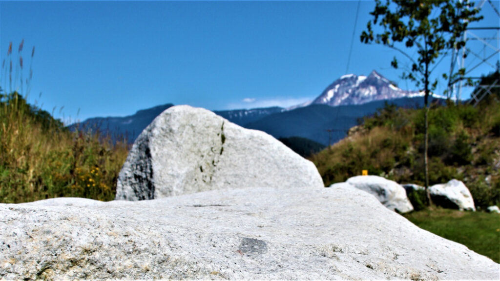
Drive slightly off the Sea-to-Sky corridor and you will come to Tantalus Lookout Point. From here, you get to marvel at the snowcapped Tantalus Mountain range, along with views of Squamish and Paradise Valley.

Tantalus, like the other peaks here, all have names that come from Greek mythology. Right below is the Lake Lovely Water. Though you won’t be able to see the lake from the side of the road, the views of the jagged mountains more than compensate for that.
Walk to the falls
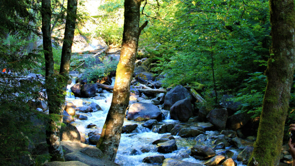
At 335m, Shannon Waterfall is British Columbia’s third tallest. It is also another popular pit-stop on your drive through the Sea-to-Sky corridor.
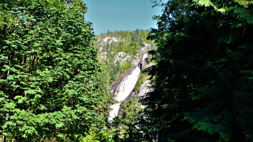
Getting to the base of the waterfall is a short 10-minute walk from the parking lot. Once you reach the base, look out for a wooden boardwalk from where you get excellent views of the waterfall. There are also a few short trails if you are up to it.
Explore sunken ships
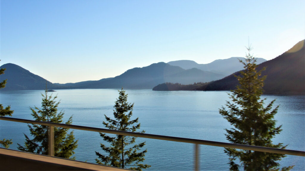
As you continue along the Sea-to-Sky corridor, you will, at some point, be driving parallel to a rail line. That’s when you know you are close to Porteau Cove, a small provincial park. If you have the time, make another pit-stop and you won’t be disappointed. Among its highlights are great views of a network of fjords called Howe Sound, the most southernly in North America. Scuba divers can also explore three ships that has been sunk. Interestingly, in case of an emergency whereby the highway cannot be used, the pier at the cove doubles up as an emergency ferry terminal

Enjoyed the drive?
While I would have loved to take as many pit-stops along the route, I could not do all of them unfortunately, as we needed to be there at our first camp site before sun fall. That should not stop you from seeing all there is to. Go ahead, take as many pit-stops on your journey.
If you enjoyed reading this blog, you may also be interested in reading about Wendake, a reconstruction of a Huron-Wendat Nation village, on the outskirts of Québec City.

Akhnaten Mallya
Part time nomad | Dreamer | Pretend entrepreneur | Advertising professional who's hardly at his desk


One Comment
Pingback: