

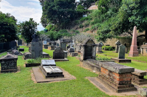
DMZ
All is quiet on the DMZ now. The bases and bunkers are no longer there. The country is one. And the area is a major tourist attraction.
However, it wasn’t always so. When the world’s powers convened in Geneva to try and sort out the mess the French had got themselves into in Indochina, Vietnam was split in half along the 17th parallel. A strip of land, running about 5kms on either side of the Ben Hai river separated a nation and its people. During the ensuing Vietnam War, the North Vietnamese and US-supported South fought ruthlessly, trying to gain an advantage over the other. In the process, it left scores dead, with civilians as collateral damage on both sides of the border.
The Rockpile
Depending on which of the tours you opt for, often, it is the first stop. It’s exactly what its name suggests – a pile of rocks in the middle of a flat field, with cliffs on all sides. If you are planning to trek all the way up, give up on that thought. It is inaccessible by foot. The only way you can see it is from the road.

Today, it is just a regular mountain today. However, during the Vietnam War, it played a major role. While its strategic importance is open to interpretation, its location brought several advantages. It acted as a listening post for the US marines, which they would pass on to the Elliot Combat Base at the foot of the Rockpile.
Its proximity to route 9 was also an advantage. Running parallel along the DMZ from Donga Ha on to Khe Sanh before becoming a dirt track as it crossed into Laos, it helped the troops stationed to stave off any attack from the North Vietnamese army.
The summit could also be easily defended. In fact, lots of marines were more than happy to be posted here, as their chances of making it through their tour was higher.
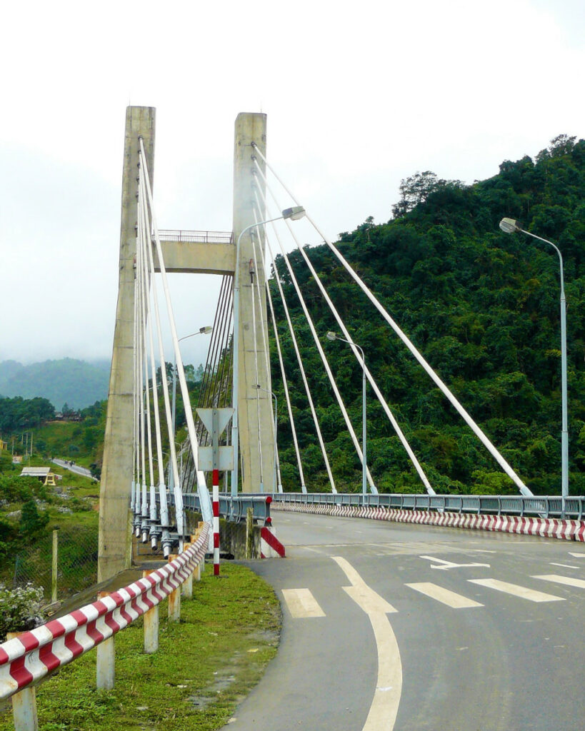
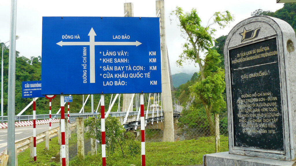
Cau Dakrong Bridge
The bridge was built as recently as 1974. While it has no relevance to the Vietnam War, it acts as a marker point for the Ho Chi Minh trail.
It’s the same trail that the North Vietnamese used to transport troops, munition supplies and even tanks to its fighters deep in the south.
However, there never was a single trail. Depending on the ground situation, the North Vietnamese would constantly keep changing their route, across 100s of kilometers, just in case the Americans caught on. Each time they did, and carpet-bombed the area, the North Vietnamese would simply chart another trail down south. In fact, there are parts of the trail that passed through Laos too, which worked out badly for them.
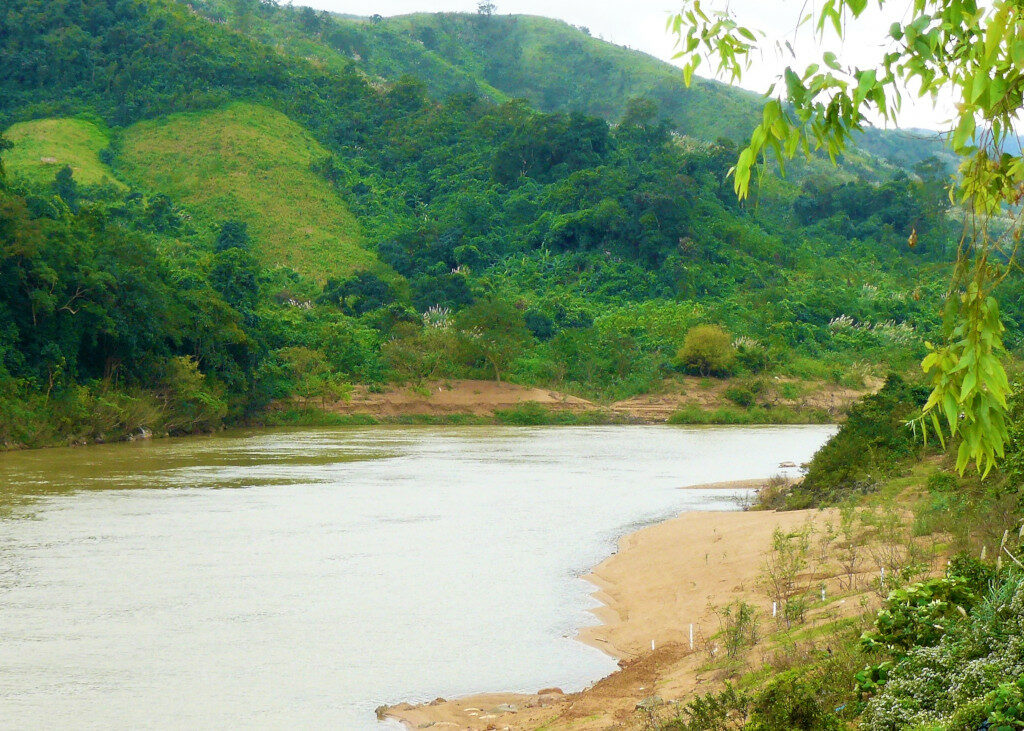
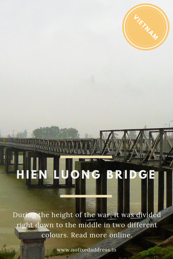
Hien Luong Bridge
The bridge, over Ben Hai river, is located on the 17th Parallel. It was what divided North and South Vietnam during the Vietnam War.
While the original bridge was destroyed, an exact replica has been constructed and placed as close to the original location. And while the country is now united, it is still a physical reminder of a time when it wasn’t.
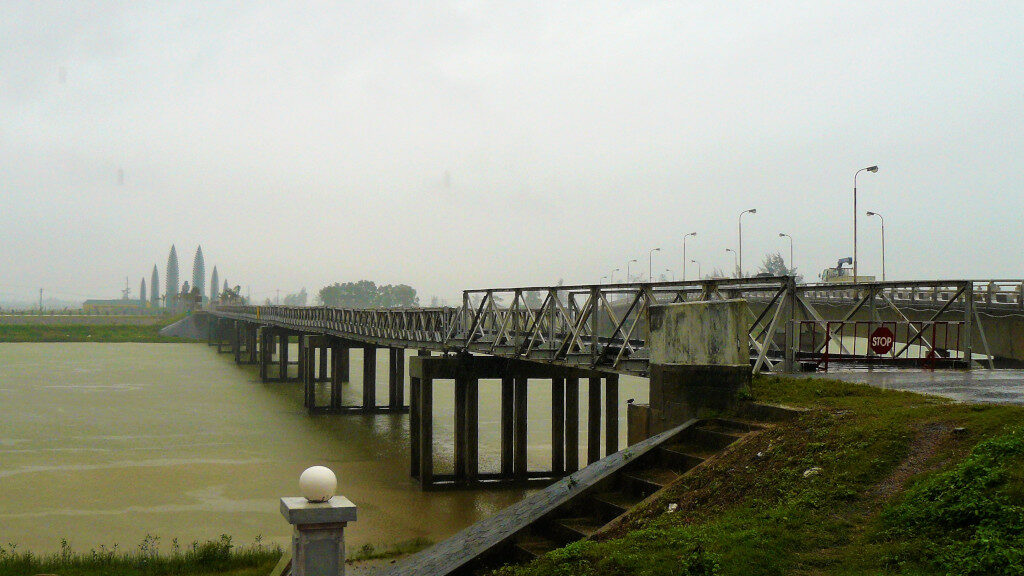
During the height of the war, it was divided right down to the middle in two different colours –blue for South and yellow for the North. As an aside, the blue was earlier red on the original bridge. This was also the point where divided families, separated by a line, could meet.
While I couldn’t cross over to the northern side (they weren’t allowing anybody that day), you can clearly see a memorial, negotiating hall, watch towers, speakers and other relics from the time. While some are from those times, the rest have all be reconstructed to give it an authentic look and feel.
Khe Sanh Combat Base
It’s the site of one of the most famous sieges during the Vietnam War. For 75 days, starting on the 21st of January 1968, the North Vietnamese continuously assaulted the Khe Sanh Combat Base.
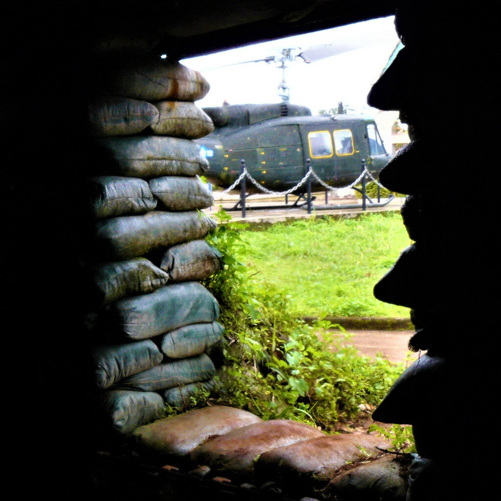
The Americans, bracing for a full-scale attack, bombed the area around the camp, with 1,000 kg bombs, white phosphorus shells, napalm, mortars and artillery rounds. In the process, around 500 Americans, 10,000 North Vietnamese and countless civilians lost their lives.
However, the expected onslaught never came. Finally, on the 7th of April 1968, after heavy fighting, the troops managed to retake route 9 and linked up with the marines to end the siege.
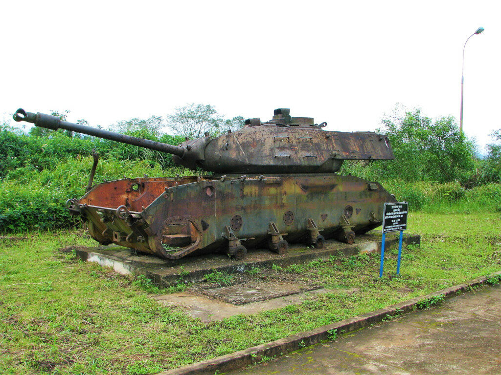
On hindsight, it seems that it was a deliberate ploy by the North Vietnamese to divert attention from the South Vietnamese population areas in preparation for the Tet offensive, which began a week after the siege started.
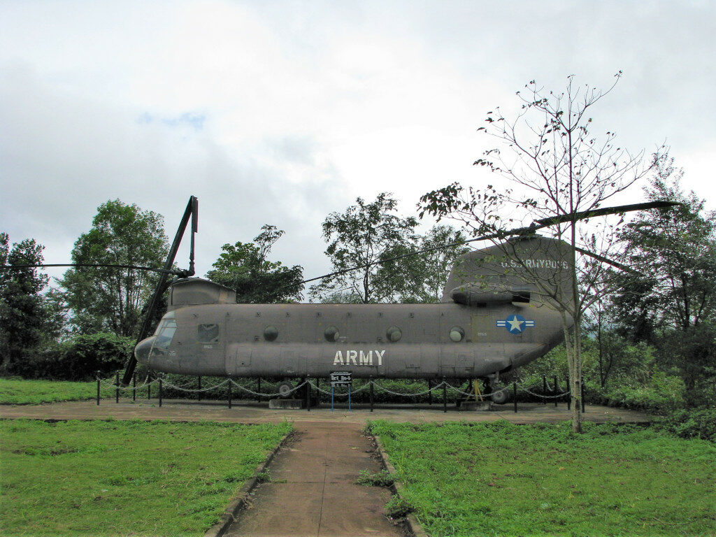
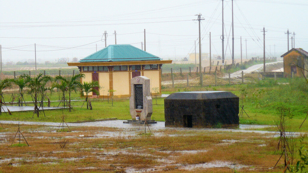
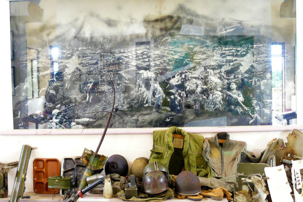
When you visit the site today, there is a small museum with historical photographs, a few reconstructed bunkers, several aircrafts, tanks and artillery left behind.
Information you can use
The only major city close by is Dong Ha, along the coast on highway 1. However, it is easily accessible from Hue and Danang.
Check with local travel agents at Hue for a day trip. Costs vary anywhere between USD 10 – 15 per person if you are going on a package tour in a bus. If you hire a private car, while it is a lot more expensive, it still allows you the liberty of of going where the buses can’t. I would advise this option. For rates, ask at the travel agency itself.
Expect to be out the full day, with your pick-up at around 6am and drop off around 5 or 6pm that same day.
See the ravages of war closer to town. Read more about the 100-year old Truong Tien Bridge over the Perfume River.
Akhnaten Mallya
Part time nomad | Dreamer | Pretend entrepreneur | Advertising professional who's hardly at his desk


3 Comments
Pingback:
Marioreilk
Emalenasajodidetipo@gmail.com
Wrotgoock
Ще одна поширена помилка – полив зверху, коли вода потрапляє на листя. Краще наливати воду в піддон або обережно під корінь, щоб уникнути загнивання.
Каланхое